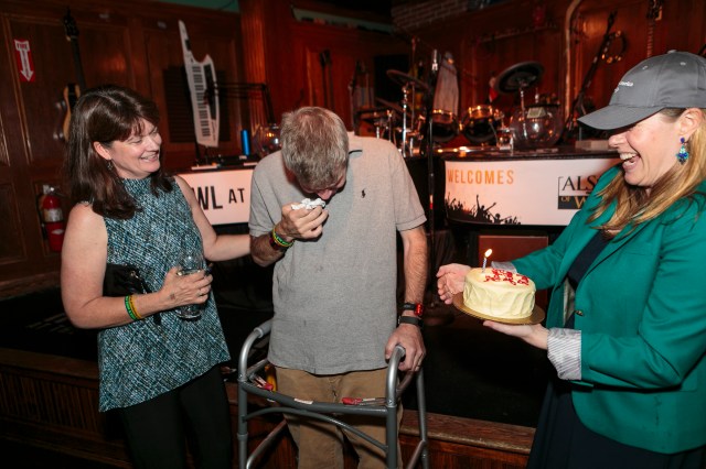
The Boy Scout Slogan is “Do a Good Turn Daily.” A Good Turn is defined as a “volunteered kind act or deed”; its purpose is to help each scout develop a habit of service and an unselfish attitude of mind. In September, Winchester’s Troop 507 did a me a Good Turn and so much more when they held “Rick’s Fall Festival” at Wright-Locke Farm here in Winchester to raise funds and awareness for ALS.
The Festival was held on beautiful day, with live music, food trucks, guided hikes on the farm’s trails, scout-led games for kids, a mini ice-bucket challenge, and a raffle in the barn. We were thrilled that so many people from the community turned out! At our fall Court of Honor last week the troop presented Jen DiMartino, Executive Director of ALS ONE, with a Big Check for the $11,938.15 raised at the event.
Assistant Senior Patrol Leader Joshua Baker, Senior Patrol Leader Will Bicks, and Scoutmaster Chris Rogers present the Big Check to Jen DiMartino, Executive Director of ALS ONE
I am fortunate to have been a part of Boy Scout Troop 507 for the last ten years, and want them to know how much I appreciate their unwavering support for me and my family. The festival was so much more than a fundraiser — I want to again thank the troop, especially Scoutmaster Chris Rogers for coming up with the idea, the committee of parents and scout leaders who spent all summer planning the event, and the scouts who worked so hard to make it such a success. I also want to gratefully acknowledge Wright-Locke Farm for the outstanding venue, the talented musicians who volunteered their time and made it a joy-filled day, and all the local merchants and friends who generously donated items for our exceptional raffle. Here are some photos from the day:
This event brings the total amount raised for ALS ONE on the “Rick’s Hike for ALS” website to $144K! This amount is far greater than I ever imagined a year ago when we set out to do something to help in the fight to find a cure for ALS. Although I finished my part of the hike in August, since then friends have continued to hike sections of the Appalachian Trail that I couldn’t do and have contributed some blog entries. I will share their stories on this site over the next few weeks. Wouldn’t it be great to get to $150K???
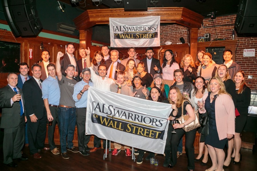
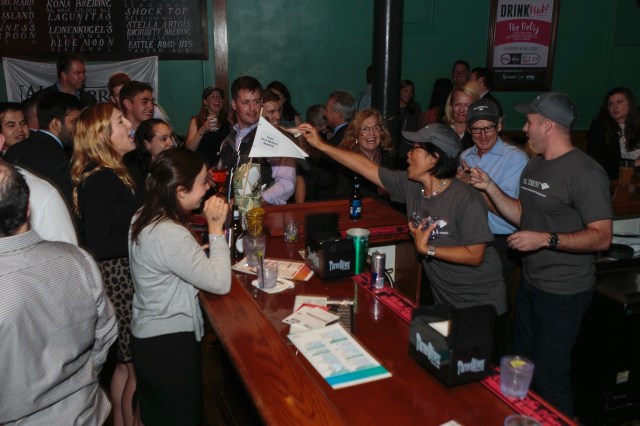
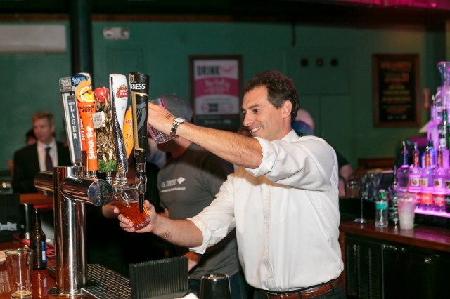
Two weeks ago the annual ALS Warriors of Wall Street fundraiser took place at Howl at the Moon bar in Boston. In this Bartending Challenge, teams from Boston financial services firms compete behind the bar for as many tips as they can get in thirty minutes. It’s all in good fun — and the event raised over $65,000 in about three hours! All proceeds go to the ALS Therapy Development Institute in Cambridge, the world’s first and largest nonprofit biotech focused solely on ALS research. I am so grateful to my friends and colleagues from US Trust/Bank of America for entering a team this year and for turning out in full force — as you can see below — to support this event!
Team “BoA Makers MARKS”
Team “BoA Makers MARKS” (love the name!) did a tremendous job, coming in 4th out of 12 teams — a fantastic debut performance! Thank you to my friend and colleague Karen Roses for taking on this challenge and spearheading such a great team, and to all of my former colleagues at the bank for turning out in full force. Apparently the event organizers said that we had the strongest presence of any team there — not a surprise at all. I am very grateful for your support.
I also want to thank my Winchester friends for coming out, especially Bill Walsh who first introduced me to the Warriors event last year just after I was diagnosed. I instantly felt part of a passionate community that is working hard to find a cure and to rally around those of us who are living with ALS now.
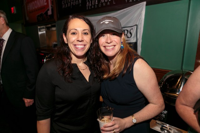
Here are some a few photos of our amazing team from the evening. To see the entire photo gallery, check out the event website at ALS Warriors of Wall Street.
The committed team from ALSTDI, plus Warriors event founder Eric Engdahl (far left) and emcee Andrew Frates (far right). Thank you all!
It’s been just over three weeks since we returned from Baxter State Park and the official end of my Epic Hike (although it continues, please read on!). It’s been a busy few weeks, as I returned to my job and we took our son Philip off to Hamilton College in upstate New York. And right now our hearts are with our family and many friends in the Houston area – you should all know that everyone here in Boston is thinking of you all and trying to find ways to help. Meanwhile, I would like to share some reflections from this summer.
I love to hike, love the outdoors, love the forests, love the mountains. I love New England, and the Green Mountains in Vermont, the White Mountains in New Hampshire, and Baxter State Park in Maine. I love the Rocky Mountains also. That is why, when I was diagnosed with ALS last October, I decided to hike to raise awareness and funds for research to fight this merciless disease. It’s something I know how to do. I hope to help find a cure by 2020 in tandem with ALS ONE and the rest of the ALS community.
OLYMPUS DIGITAL CAMERA
I had never hiked the Appalachian Trail except for some individual mountains here and there over the years, but it’s always been a goal. That is why I decided to hike the final 600 miles of the AT from Mount Greylock to Mount Katahdin. Last October I felt I could climb every step of the way because I was in good shape at the time. However, I had to wait eight months for summer in New England to begin. Over this time ALS affected me; in particular, the left side of my body was weaker. I had to get a foot brace because my left foot was weak and floppy, and a neck brace to support those muscles.
We started on June 17th, and it became clear pretty quickly after the first few days that I would have to scale back my aspirations for the trek. I had to skip certain sections of the White Mountains because they were too difficult. I also had to skip the infamously rigorous parts of Maine, notably the Mahoosuc Range and the 100 Mile Wilderness. But I ended up hiking 128 miles, including Mount Washington, the tallest mountain in New England. I want to thank all the people who joined me on the AT – forty-five people in all! I could not have done this without you, my friends. You have given strength to me and my family, and brought significant awareness to the fight against ALS. We were glad to have the chance to celebrate with you all on a very special evening, with heartfelt thanks to our good friends Audrey Loria and Laura Krotky.
I want to thank all of the people who donated to ALS ONE and who commented on my blog or donation page. Your encouragement meant a lot to me and kept me motivated when I got tired. Finally, I want to thank Bank of America for giving me eight weeks of paid leave so I could complete my Epic Hike, and my outstanding colleagues past and present who have supported me over the thirty years I have been with the bank. My last day will be September 15th, when I will go on long-term disability.
I was disappointed not to be able to hike every one of the 600 miles this summer. To my surprise and delight, however, other people stepped in along the way to hike some of the most challenging sections, including as you know 10th grader Tori Barrow who completed the 100 Mile Wilderness and Boy Scout Troop 507 who summitted Mt. Katahdin. Overall my friends hiked an additional 247 miles of the AT, for a total of 375 miles toward the original goal. But it’s not over! Your efforts are continuing, and I hope that together we can complete the entire 600 miles by the end of this year. Stay tuned to this blog for occasional posts on our collective progress.
Meanwhile, over the past three weeks since we got back from Maine I’ve had a chance to help in the battle against ALS in a couple of other ways. On July 18th Eileen and I were honored to attend Massachusetts Governor Charlie Baker’s signing of the Ice Bucket Challenge Week Bill at our State House, along with Pete Frates and his family, Jen DiMartino from ALS ONE and other ALS advocates. Since 2014 the Ice Bucket Challenge has raised over $200 million for ALS research and care. We were also happy to join in the pre-race dinner for the 125 runners on the ALS ONE team for the Falmouth Road Race who together raised over $250K – we encourage all of our runner friends to consider joining the ALS ONE team next August!
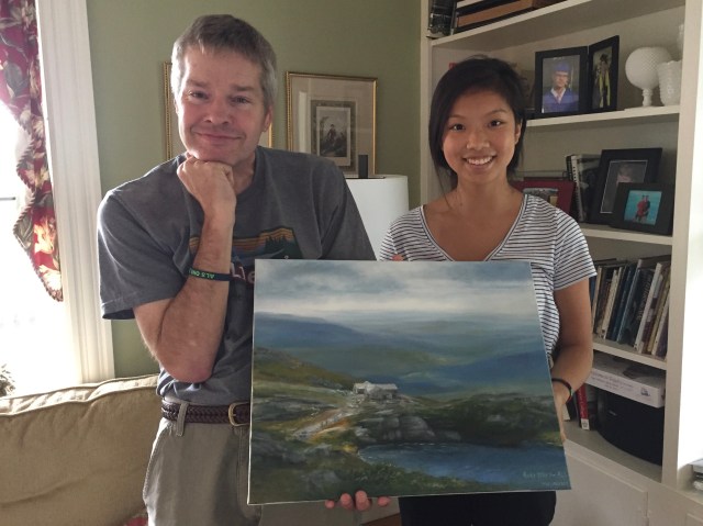
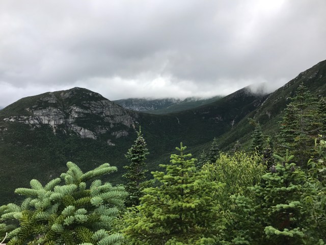
Yesterday, I received an extraordinary gift from Winnie Li, a friend and Winchester High School classmate of Philip’s. Among her many talents, Winnie is a painter. Last month she asked what some of my favorite moments on the trail have been. She then worked from photos to create this beautiful rendering of the Lakes of the Clouds Hut as seen looking back from the ascent of Mt. Washington. I will treasure Winnie’s gift, her kindness, and this memory of a truly unforgettable journey. We wish Winnie the best as she embarks on her studies at Northeastern University.
Boy Scout Troop 507 continues its unwavering support for our family. We are looking forward to Rick’s Fall Festival at Wright-Locke Farm in Winchester on September 10th from 3-7pm to benefit ALS ONE. This family-friendly event, open to the public, is being hosted by Troop 507 and Wright-Locke Farm, and will feature food, games, hiking, raffles and live music. For more information visit Rick’s Fall Festival. We hope to see all our Boston-area friends there, and meet some new ones!
Tonight’s blog, the final one in the Katahdin series, is by Tom Simard on behalf of the group of nine who summitted Mt. Katahdin then returned via the Abol Trail.
The Ascent
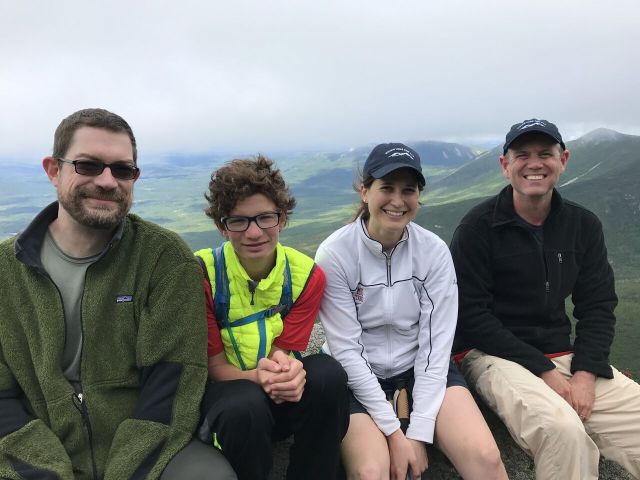
Our hike up the 5.2 mile Hunt Trail on fabled Mt. Katahdin began around 6:30am from the Katahdin Stream Campground. After taking the requisite “before” group photo, our team of 9, which included Karina, Jason, James, Jasper, Brian, Jerry, Max, Eric, and Tom signed in at the trailhead as “ALS ONE.” We quickly covered the first mile of the ascent to the beautiful Katahdin falls where we stopped for the first of many rests on the way up. From there, the trail steepened considerably and we made our way methodically up to the treeline in beautifully cool but comfortable summer hiking weather.
James, Jasper, Karina, and Jason
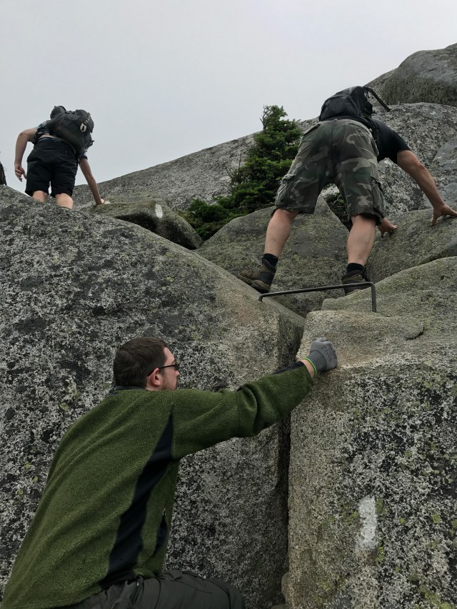
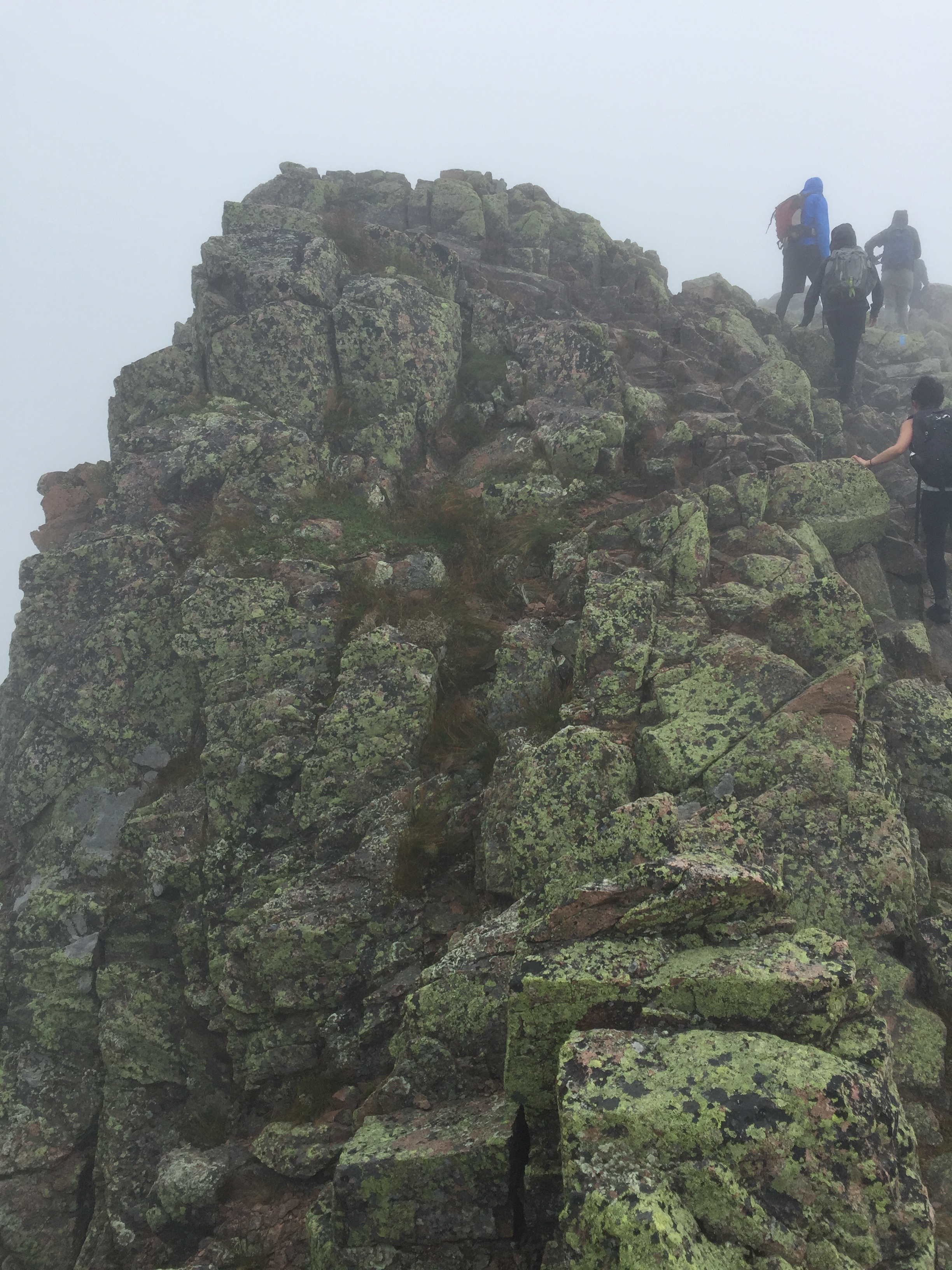
By the time we reached the ridgeline above the trees where only a few hardy plants could grow, the trail turned skyward, and hiking turned into rock climbing. The scrambling was strenuous, though aided by helpful hardware drilled into the granite boulders with the famous white blazes painted on them. It did give our legs time to recover a bit as we were now scaling with the use of our hands, arms, hips – really anything we could use to hoist ourselves up the spur. Almost suddenly, early winter arrived … sideways. Each of us dug into our packs and donned whatever warm items of clothing we’d brought “just in case.”
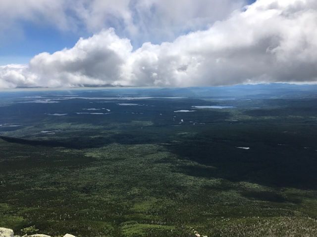
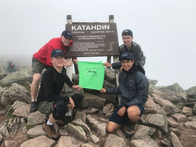
Penobscot legend says that the storm God “Pamola” was believed to be the protector of the mountain and reputedly inflicted punishment upon those who dared to summit from below. It certainly felt like someone or something didn’t want us there as the clouds moved furiously across our path as if in a rush to get to the Atlantic Ocean. After an eternity on the rocks, we finally reached the mysterious tablelands section of the trail which in the cloudy mist resembled a Lord of the Rings film set. With only a mile left to go from the Thoreau Spring, we continued on. The telltale signs of the summit reached our ears first as the voices of those who passed us on the way became audible just before we caught sight of the famous Katahdin sign as it appeared through the foggy cold air. We made it! We only stayed long enough on the exposed peak to eat a quick lunch and take the group photo in front of the sign marking the northern terminus of the Appalachian Trail.
The Descent
Earlier on our hike, someone in our group had mentioned some local words to the effect that going up Katahdin is optional – coming down, however, is not. Realizing now that our journey was really just halfway through, and with the winds and cold rain pelting us from seemingly every direction we began our descent back down the Hunt Trail to the Thoreau Spring sign and junction with the Abol Trail and the Baxter Peak cutoff. It was at that point that we stopped to take a headcount and make a decision about whether to take the alternate Abol route down. That’s when we realized we should have taken a headcount at the summit. Max and Eric were not with us, and worry set in. As hikers passed us going up and coming down, we asked if they had seen the father and son team. Jerry and Karina selflessly volunteered to return the way we had come – up the mountain – with the hope of reconnecting with them and meeting up with the rest of us down the Abol Trail. The upper section of the Abol was steep and the going was slow, but our hiking team was now split in half so our best chance of reconnecting on the way down was to take it slowly and take breaks. And so we did. Still above the treeline, we waited along a new switchback section of the Abol Trail where a group of large granite boulders formed a makeshift wind shelter. Just a few minutes later, the team of Max, Eric, Karina and Jerry appeared on the ridgeline above us, and it wasn’t long before we were reunited again for the rest of the descent.
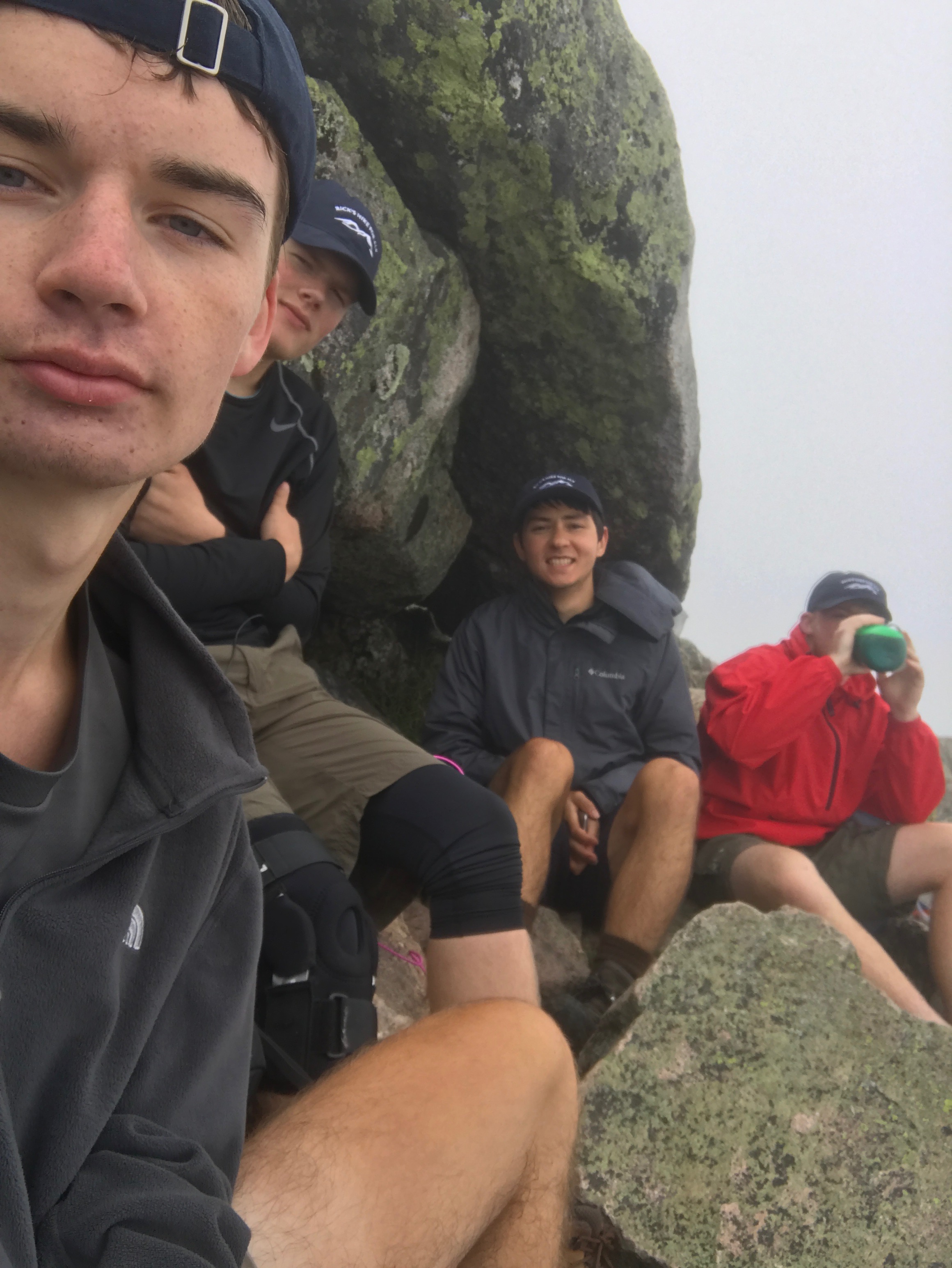
The new addition of the switchbacks lessened the impact on our tired knees somewhat, but we forged on single file with someone designated to lead in front and someone taking up the caboose. My iPhone’s compass app kept telling us how far we had to go. By the time we’d reached the trees, the temperatures returned to seasonal levels again and we stopped to stow our raingear and heavy wet clothes. The rest of the descent was relatively uneventful, though the spirited conversations that had become our norm were quieter now that we were all tired and yearning for signs of the Abol Campground. Jasper was the first to see a lean-to, indicating that we had made it! Yay! Then we remembered our cars were parked two miles up the unpaved road. The slog continued, but now on the Tote road with cars passing us in the opposite direction, so no chance to beg for a lift to our destination. Finally, we arrived back where we started, exhausted, relieved, accomplished. My iPhone told me we’d taken over 32,000 steps, though it felt like many more than that. As we were preparing to leave, Eileen, Rick and the Knife Edge boys arrived just in time for a group photo just as we’d done nearly twelve hours earlier.
Max, Eric, James, Jasper, Jerry, Karina, Tom & BrianWe did it!
Rick’s commitment to take on this challenge has inspired hundreds of people. His love of hiking and the outdoors, and his love for his family and his community have touched all of us in some way. For me, it brought back special memories of growing up in NH, hiking the Whites with my family, and camping in the shadows of the Presidential Range. This weekend it brought together erstwhile strangers, now friends, who are privileged to have been a part of this inspiring journey. Thank you, Rick, and God bless you.
Today’s blog is from Eric Chen, a rising 8th grader and member of Troop 507. Thank you Eric for being a part of this weekend and taking on the challenge of Mt. Katahdin for me!
So, my pack is full and ready to go, and we’ve registered at the trailhead. We are going on a 10 hour, 13 mile hike to the summit of Mount Katahdin. It is the tallest mountain in Maine, at 5,267 feet. This is literally my first real mountain summit, so I’m really going big to start off my hiking career. I also haven’t exercised in a while, so we’ll see how this turns out. We are doing this hike for one of our Boy Scout troop leaders, who was diagnosed with ALS in October of 2016. He is hiking the last 600 miles of the trail, from Massachusetts to Maine to raise awareness and funding for a cure for ALS. I am so excited to have this opportunity!
Eric and his dad Max
Hour 1: The first hour comes fine. The trail hasn’t gotten too steep yet, and my stamina holds up. It’s still warm enough not to wear any other layers, but I can tell it won’t be like this for long. Here’s our trail profile:
Hour 2: At the start of this hour, the only difference from the first hour is that there are many more larger rocks to climb over. I have already gone through half a bottle of water out of three full ones, but I think I should be okay for now.
Now the trail starts to be much rougher. It’s kind of like stairs, except each stair is tilted and three feet high. My dad didn’t have a pair of hiking shoes, so thank goodness he got a pair last minute. Without hiking shoes, your ankles would really get it.
Hour 3: The road is very difficult now, and involves you using everything you can, arms, legs, hips to get over some obstacles. We have already passed the treeline, but it isn’t a particularly sunny day, so the sun isn’t the most of our worries. I have already gotten a cut and reopened one of my other cuts, but there’s only a little bit of blood. But the view, wow! We are eye to eye with the clouds, with rays of sunlight searching for a gap in them to shine on the ground below. Our group, which consists of nine people, is separating slowly, the stronger climbers going ahead and the rest staying with the group. I’m kind of in the middle. I haven’t had anything to eat yet since the start, which is surprising considering I usually eat a lot of snacks even when I’m not exercising. Well, not a lot, but more than nothing.
Hour 4: Now the real risk kicks in. One bad move and you’re over the edge. It’s gotten so bad that they had to put some iron bars to use as foot holds. I have already had to get help from others to pull me up some of the boulders since I’m not tall enough. I am actually more nervous about falling at this point than anything else. But it’s still amazing. I didn’t think this is what I signed up for. I thought it was going to be a much much smoother climb, but instead, I get this:
And that isn’t even close to the worst of it. I don’t know why I even thought that this would be easy. We are summiting a mountain, not a stepstool! My backpack is also really starting to get in the way. Every time I lean forwards to grab onto a handhold it falls over my shoulders and covers my eyes, which isn’t good if you like seeing.
Also, since we are in the clouds we can’t really see where we are going. Like, we can see about up to 50 feet away, but nothing else, so we have no idea what is to come later on. All we know is that we are going to hit a tabletop region soon, which is flat, hence the name “tabletop”. Afterwards, it’s just another scramble up to the summit! We are so close!
Hour 5: We finally make it to the summit! Honestly, I was expecting a little more than what we got. It was quite anticlimactic, for me at least. I think it is partly because we could barely see anything because of the clouds. It is basically a blizzard, but with water vapor. We don’t have a real lunch, so we snack on some stuff that we brought. I was hiding behind a rock to get shelter from the wind. The wind is actually the thing making it cold and unbearable. Without it, I think I would have been fine with just my sweatshirt.
So, after we finish taking a bunch of pictures and stuff, my dad and I go back to clean up our trash, and that’s when things get messed up. Apparently, the group forgot to do a headcount before they left, so my dad and I were left at the top of the mountain. We figure out eventually that they had already left, so we went back along the path that we came to find them, or so we, or I, thought. The fog was blurring my vision, so in the distance, I thought I see a silhouette of one of our group members. I don’t even stop to check which path it was leading us down, I just went. So, my dad and I stay on this path for a while, and I soon feel that something is wrong. The path is different than our previous one, and there was a large boulder that definitely was not there before. It is now that I knew for sure that we went the wrong way. First, I tell my dad. We have a couple choices. One, keep heading down the path that we were on and have them pick us up when we get to the bottom. Two, return to the summit and go down the other trail. Or three, go on a side trail that would eventually intersect with the trail we were supposed to be on. We choose to go back, since we had only gone half a mile down the wrong path, I felt like that was the best choice. I really didn’t want to risk going down this trail, because I had no idea what we would be in for.
I was really feeling the nerves then. I knew we weren’t, but I felt as if we were completely lost. The wind and fog definitely helped set the scene. I actually got to the point where I was reassuring myself by trying to make myself laugh. Anyone up for some Bear Grylls commentating?
We finally make it back to the top. The whole thing only took us about 30 minutes, the down and back. I felt really guilty about leading us into this mess, and mad at myself for not checking the trail sign before we left. At least we were on the right trail now.
Hour 6: 20 minutes after leaving the summit for the second time, we meet a woman that had seen our group pass. They must have told her about us missing because she asks us if we were Max and Eric, then proceeds to tell us where our group was waiting. We thank her, and I finally felt that weight come off my shoulders. At least we were heading the right way.
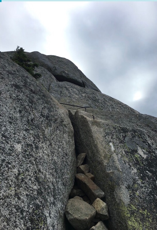
Meeting back up with them was the most awkward. They tell us that people told them that we were on the Knife Edge. Ohh! So that’s what the Knife Edge was! Apparently, if we had gone further down the trail it would have looked like this:
Good thing we didn’t go down that way.
Hour 7 – 9: There’s honestly not much to say about going down. It was certainly hard, and the front of my shoes kept bending my toenails back, but it’s hard to describe the process of going down. Well, they say a picture is worth a thousand words, right?
Hour 10: The last hour was most definitely the hardest hour, for me anyway. We came down the mountain a different way we did when we went up, so when we got to the base, we were still two miles away from where we parked our cars. Those two miles were the fall of me. At first, I am glad that we had some flat road we could walk on. It felt like a bunch of rubber bands had been squeezing your legs, but now they were finally being released. Halfway into the walk, I am starting to feel more of a burn in my feet, but it was still tolerable. The last quarter mile was like if I dunked my feet in a bucket of tacks. I don’t even know why they hurt so much. I couldn’t really limp either because both feet were hurt, so that would make no sense. I was actually on the verge of just sitting down on the gravel road to rest.
When we finally made it to the cars, I was so frustrated at the pain that I immediately threw my stuff in the car and took off everything surrounding my feet. This was definitely a challenging experience, one that involved patience, strength, teamwork, and quite a lot of encouragement. It really opened my eyes to the persistence and determination of the hiking community, and even more so to everybody that’s helped Rick and followed him on this journey. Just thinking about what I just did really puts all the other times I complained that my leg hurt, or my foot hurt to shame. The Walk for Hunger doesn’t even look so intimidating anymore. This might even kickstart a hiking tradition for me, but we’ll see about that.
Of course, lastly I would like to congratulate Rick for completing this journey. The patience and determination needed to finish this task is basically immeasurable, but you did it.
I would also like to thank everybody for giving me this opportunity and helping me throughout the whole climb. Thank you all!
By: Joseph D. Wong, Tyler F. Donovan, & Brandon T. Whelan
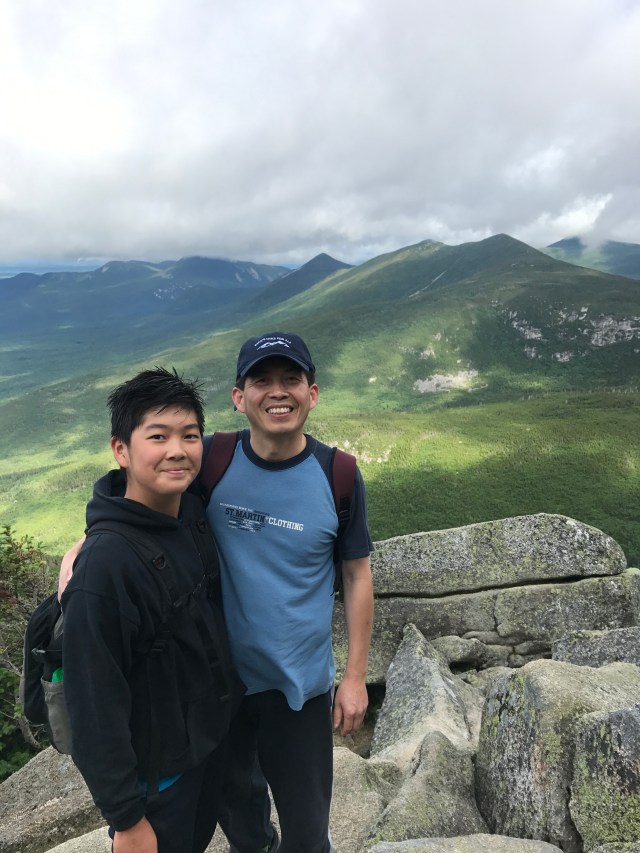
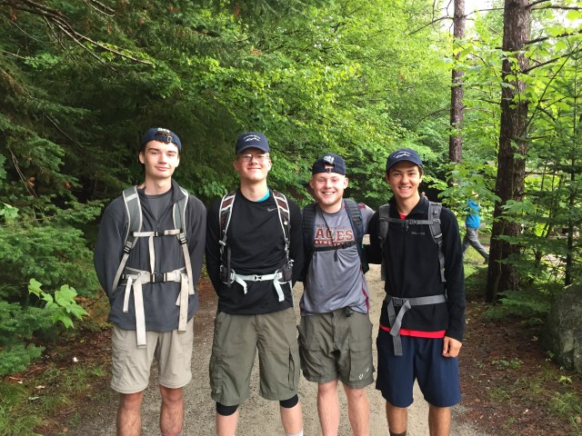
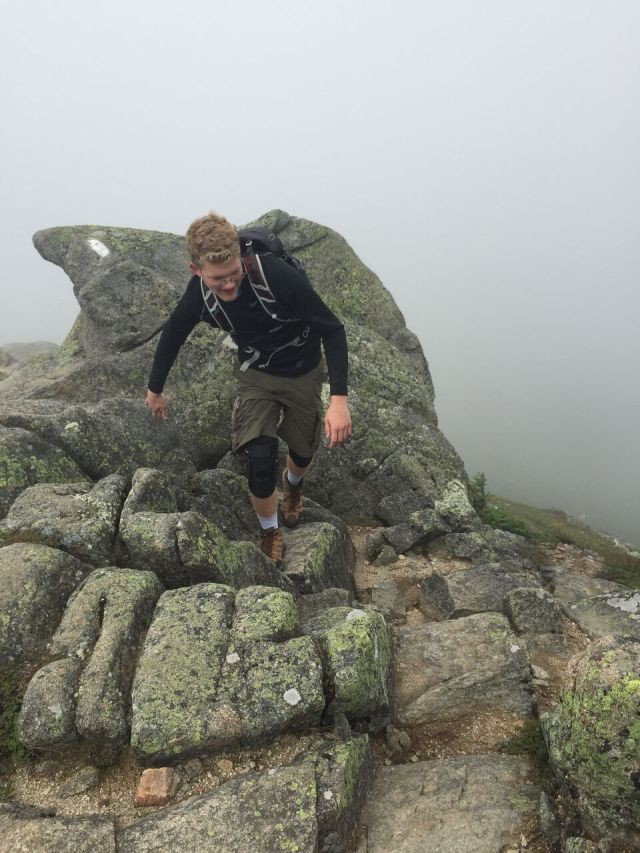
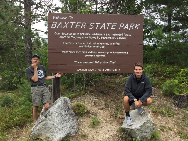
Joseph: I woke up to the repetitive beeps of my watch and turned over in my sleeping bag. 4:55am it read. Today was Sunday. Stuffed from burritos consumed the previous evening, we crawled out of our tents to begin the 13 mile drive south to Katahdin Stream Campground, where the last leg of the Appalachian Trail, known as the Hunt Trail, ascends Mount Katahdin. “You are now entering Maine’s largest wilderness,” read a sign as we wrote our names down in the hikers’ log book. Brandon Whelan, Tyler Donovan, Philip Marks, and I, Joseph Wong, began our 5.2 mile ascent to the summit of Mount Katahdin.
Philip, Tyler, Brandon, and Joseph
Of course on our way up we were passed by several hikers including children half our age and some other characters wearing sandals of all things. I think we all scratched our heads at this one. After roughly three miles of meandering through the forest, we ascended above the treeline and were soon scrambling up sheer rock, squeezing through spaces no more than two feet wide.
Soon the trail got steeper, the wind got stronger, and the fog got denser. But the trail kept going on and on. On either side of the trail was a deep abyss of fog hundreds of feet deep. We had no idea how far we had traveled, nor how much we had left. Finally, the Hunt Trail converged with the Abol Trail and the landscape flattened out; it became mossy and gradual with algae-covered boulders. Countless times we believed the summit was in view but were all dumbfounded when the fog revealed just another ridgeline. Finally, we saw a gathering of hikers and a prominent wooden sign emerge from the fog ahead of us. Philip led the way for the last 25 yards and we nearly started running in excitement. After four arduous hours of hiking, the words “Northern Terminus of the Appalachian Trail” provided an unfathomable amount of humble triumph.
We proceeded to take our pictures and even scraped a bit of LTE out of our iPhones. Holding onto our hats, we savored the moment 5,267 feet up in the clouds.
I must now mention how on Saturday, Mrs. Marks told us how Philip had wanted to hike the Knife Edge Trail on the descent. Hearing this, Brandon, Tyler and I were like “oh boy let’s go!” excited that he shared our desire. I’ll now turn the story over to Tyler where he will explain how that excitement converted into some twisted mixture of fear and regret.
Tyler: After momentously summiting Katahdin in honor of Mr. Marks we poked around the exposed peak looking for a place to nestle for lunch. We found a large rock that blocked the wind, enabling Joseph to cook the beef stroganoff he had been raving about. We refueled and prepared for our descent down the mountain. After hearing all the stories of how the Knife Edge Trail is a once-in-a-lifetime experience, we had our minds set on this route. We also heard the stories of some of the 63 people who never got to complete their trek across the ridge. Turning to each other we said “we’re here and we for sure aren’t turning back now.” We started our hike into what seemed to be light fog which persisted for about a quarter of the way through.
Then Mother Nature decided to let loose. The fog densely thickened and we could only see about 30 feet in front of us. The clouds we were travelling through pelted us with a cold, unforgiving rain that fogged my glasses and heightened this experience. The winds were gusting well over 40 mph and blowing us over, especially when we reached another peak in the ridge. I wouldn’t exactly call this a hike, but instead a climb, as our grip rapidly wore away with each grasp of the rock in front of us. The ridge went up then down then up then down at least seven times. At this point we once again had no idea of our progress on this seemingly short 1.1 mile trail. Looking down on my left or my right was nothing but a straight drop that descended at least 2000 feet.
I think we could all agree this was the scariest experience of our lives thus far. We all held onto the rocks and half-heartedly bickered as the conditions continued to deteriorate. “Never again,” we kept saying to each other. The two women behind us turned back roughly halfway through as a summit-bound hiker explained to them that the trail gets no better. Even the group in front of us began muttering swears at a rapid rate. As many of you can probably imagine, here were four supposedly fearless boys hiking across the ridge because it was indeed just stupid scary. The group ahead of us was led by what seemed to be an experienced hiker so we linked up and continued to crawl across the rock. The trail was constant up and down, climbing then crawling then holding on for dear life as a gust attempted to blow you off the ridge. Finally, we reached the crevasse Mrs. Marks had told us about and knew we were close to the end of this section.
Sliding down on our backs and straddling the boulders we descended down the worst section triumphantly. We completed this crazy task and we have all agreed never to do it again.
My family has this motto that we live by when given certain situations; it’s “sleep when you’re dead.” (Tyler). Tyler said this a lot on the trails and it sounded ridiculous at some points and totally agreeable at others. I will now hand over the remainder of our journey to Brandon.
Brandon: As we reached the end of the Knife Edge, I remember a great feeling of relief. We had done (what I thought at the time) the longest part of the journey. Before we even began, Mrs. Marks had told us how, on our way down from the knife’s edge, we would end up going down the Helon-Taylor Trail and how the trail was a “very nice trail” and “not hard at all.” Well, I now know that after hiking for some 7 straight hours, any trail becomes hard. As we made our descent from the final peak of the knife’s edge, we could see the end of our trail. It looked great, sunny, not very windy, and a wonderful view of rainbows, lakes, and green for miles and miles.
But as we hiked on, we realized the trail was not as short as we thought. It also got very windy on the way down. So windy, in fact, that my hat flew right off my head, leaving Joseph to descend 50-70 feet to retrieve it. We stopped for a short while to call our families, I called my mom (who of course didn’t answer her phone) and my grandmother, who was extremely pleased that we made it, and that everyone loved her brownies. Tyler called his house phone. No one answered. This led to three of the worst voice-mails any of us had ever heard. It took us around an hour to get to the tree line, and another hour to get to a sign that read “Helon-Taylor, Trail End: .1 miles.” We practically ran to the end of the trail where we found Mr. and Mrs. Marks waiting to congratulate us at the Roaring Brook campground.
We took pictures and squished in the back of Mrs. Marks’ Jeep to return to the campsite. It is important to mention that on the ride back to the campground, I fell asleep in the car. Behind Joseph. Forcing him to sit in a very uncomfortable position. But that’s what friends do for each other.
Me, Ty, and Joe have been really good friends for years. And I’m glad to say we made another really good friend in Phil. I don’t think we would do that hike again if we had a choice, but I’m also really glad we got to do this for Mr. Marks, who has been such an inspiration to so many. I don’t think we would have made it up and down that mountain without thinking about him.
As mentioned yesterday, we had a great finale at Baxter State Park this weekend.
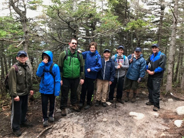
For the climb of Mt. Katahdin, our group of eighteen divided into three smaller groups. Tonight’s blog is from Joan Swift, neighbor to the Marks family and fellow scout parent, recounting the experience of one of these groups.
From Joan: Early in the morning on Saturday, August 5, a small convoy of scouts from Troop 507 in Winchester set out for Baxter State Park. This group also included Eileen and Rick’s friends Tom Simard and Brian Spies who, in true scout spirit, offered to drive some scouts and camping gear. The convoy eked its way north, stopping for a quick lunch to break up the 6+ hour ride. We arrived mid-afternoon under sunny skies to find Rick, Eileen and Philip setting up a tent in the camping area. Quickly, we all joined in and our campsite on Nesowadnehunk Field Campground would do a scouter mom or dad proud. Tyler, Brandon, Joseph and Philip went off for a swim in nearby Ledge Falls while the rest of us went to ‘stretch our legs’ on the Wassataquoik Lake Trail close to the campsite. We fell into an easy camaraderie from the start as we all were here to support Rick and his hike for ALS. The forest in Baxter State Park is so thick and dense, we were questioning how the deer and moose could make their way through (unfortunately, this was not brought on by a moose sighting).
As we regrouped, the scouts took charge, lit a fire and prepared one amazing hot taco dinner — courtesy of and kudos to Brandon and Tyler’s mothers, Colleen and Laurie. A few raindrops trickled in as the marshmallows and brownies (thank you Brandon’s grandmother!) were enjoyed. Max, Jerry and Eric arrived just in time for dinner and to set up for the night — a night filled with pouring rain, thunder and lightning. Fortunately most of us were able to tuck in just before the skies opened up. Most of us except Jasper, James, Katrina and Jason, who arrived amidst the downpour and quickly tucked away in a nearby lean-to.
On Sunday morning at 5:30 a.m. (yawn), the entire group including Rick and Eileen once again convoyed, this time to the Katahdin Stream parking lot for the ascent of Mt. Katahdin. We grabbed a group picture and took off on our paths.
Front: Max Chen, Matthew Swift, Karina Pikhart, Jerry Li, Eileen Marks, Tom Simard, Joseph Wong; Back: Joan Swift, Tim Swift, Eric Chen, Jason Innes, Jasper Schultz, James Schultz, Philip Marks, Rick Marks, Tyler Donovan, Brandon Whelan, Brian Spies
The majority of the group headed up the Hunt Trail (the final leg of the AT!) to the summit, while my husband Tim, son Matthew and I made our way with Rick and Eileen about a mile up the Hunt Trail to Katahdin Falls. Rick’s hiking skills were evident as he managed to tackle the rocky climb, the wet rocks and the sandy trail. Along the way, we enjoyed some tricky ascents, lots of waterfalls, Indian pipe and the fresh smell of Christmas trees. We were passed by three thru-hikers — Shortcut, Little Bear Stumbles, and Soulflower — who had met Rick on an earlier part of the AT. Most of all, we were able to spend quality time as family and friends to support each other and the fight against ALS.
Finally, I am eager to hear about the journey to the summit and the infamous Knife Edge from the others. (Part II – The Summit, tomorrow)
From Eileen: For me, one of the unexpected and very special aspects of this entire experience has been hearing from people that Rick or his journey has impacted in some way. Last night we received this beautiful contribution to Rick’s hike from our friend Chaney Dalton, who hiked 5.4 miles this weekend for him. Thank you Chaney for braving the storm for Rick.
My name is Chaney. I am 16 years old and I’ve known Rick my entire life. He is my brother’s Godfather. I wish I could have hiked with Rick. Instead my dad and I hiked Algonquin Trail on Sandwich Notch Road for him. We planned to summit Sandwich Dome but it started storming so we couldn’t summit. It was so foggy we couldn’t see more than 20 feet in front of us. The rocks were slippery and hard to climb. We were soggy and wet, but we enjoyed the challenge. We were happy we could hike in honor of Rick. I’m so inspired by Rick and his dedication to raising money for other people who have ALS. And I feel very lucky I know him 🙂
From Eileen: We made it back tonight from Maine. It was a great weekend at Baxter State Park with Troop 507 and friends — 18 of us in total. We are pulling the blog together along with some great photos, and hope to have it posted tomorrow night! Meanwhile, here are some other things that happened this weekend:
On Friday, Rick, Philip and I made a slight detour on our way to Baxter to stop by the Abol Bridge over the Penobscot River, which is the boundary between the 100 Mile Wilderness and Baxter State Park. In honor of Tori Barrow, who confidently completed these 100 miles and more (see Day 47), we hiked in about 50 yards to take our picture with the sign:
While a few days earlier our friend Liz Kinchen and her buddy Rose hiked Mount Major, in New Hampshire, in Rick’s name. As you can see, the summit rewards you with a gorgeous view of Lake Winnipesaukee. Thank you Liz!
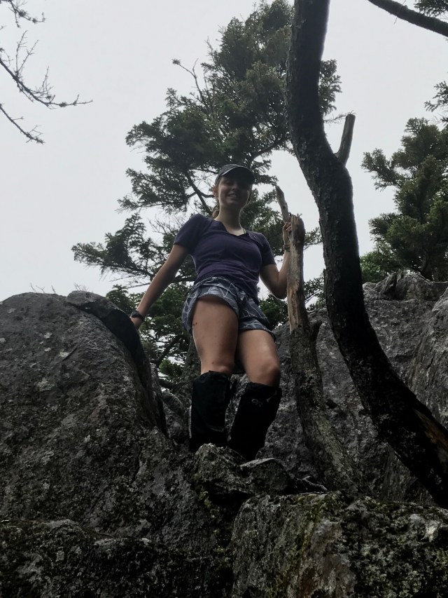
We continue our weekend in Baxter State Park with no cell service…meanwhile, today’s blog is from our friends Laura Krotky and Rusty Sullivan and their sons Ramsey and Owen. Laura and Rusty have been very supportive to our family since I was diagnosed last fall. They hiked the Lonesome Lake section of the AT for me last weekend. Thank you for enabling me to check off this part of the trail!
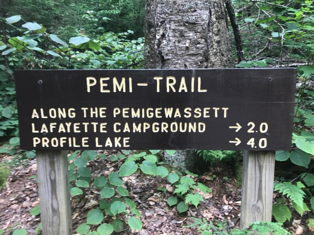
From Laura: Russ, Ramsey, Owen and I headed to Franconia Notch in New Hampshire to hike a bit of the AT that Rick won’t get to. We chose the Lonesome Lake trail, mostly because it was ranked “moderate” rather than “difficult” in our hiking guide. If you ask me, it was more challenging than the guide suggests. If you ask Ramsey and Owen, they would say I am not hike-worthy!! Regardless, it was absolutely beautiful the entire hike (which is why I stopped so often—to admire nature—not to catch my breath!) Thank you Rick for giving us a reason to break out our walking sticks. Now that I have walked a few miles on the AT, I am more in awe of you and all you’ve done to find a cure!!
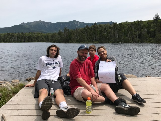
Ramsey, Rusty, Owen and Laura at Lonesome LakeLaura, “an inexperienced hiker,” says she is sorry she took a photo of the wrong sign!