When you read this we will be in Baxter State Park, where there is no cell service. We will update you all on the weekend’s adventures when we return on Monday. Today’s blog is from my friend Anne Sharp, who hiked Mt. Jackson on the AT in New Hampshire on Monday with Jen Lockwood and Lisa Cleary. They helped spread the word about my hike with some eye-catching bandanas that Jen created to put on their backpacks! Look for them again at the top of Mt. Katahdin. Thank you Anne, Jen and Lisa!
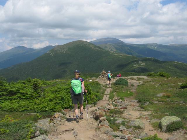
From Anne: I think we all woke before the alarm went off early Monday morning. Jen, Lisa and I had arranged to meet at 7:30am at the Dunkin Donuts at Exit 23 on 93N. The weather forecast had been a moving target and we wanted to be off the mountain before the risk of thunderstorms became a reality. We were at the trailhead by 9am. On our way up we met many hikers and told them all about Rick’s mission to help find a cure for ALS. Everyone was very supportive. Thank you if you are reading this blog for the first time!
The views from the top of Mt. Jackson were spectacular in every direction. We stopped for a snack and continued to spread the word with the many fellow hikers we met. Then it was off to Mizpah Hut for lunch. If you can believe it, all three of us had on previous hikes been within .1 mile of Mt. Pierce without summiting! We were determined to rectify that today. Once again the views from Mt. Pierce were amazing. We could identify many of the peaks along the Presidential traverse.
We returned via Crawford Path, reaching Rt 302 at 3:30pm, very happy to beat the rain which started 5 minutes after we were safely in the car!
Thanks Rick for letting us check this one off your AT peaks list. We all had so much fun and thought of you often. You are such an inspiration!
Hey folks, Philip here (Steady’s son). Disclaimer: I apologize if this turns out to be long, I like to write…
Day 1
Four people set out at an absurd time Wednesday morning (6:00am) to reach our entry point of the Appalachian Trail near Millinocket, ME. My hero of a mother dropped my dad, Steve Bell, and me off at a point where the AT crosses a logging road (that’s why we bought a jeep!). On said logging road the four of us witnessed the first moose sighting of Dad’s hike! Before I begin my tale, though, I’d like to give a personal shoutout to Mr. Bell; he is one of just a few people who has hiked with my dad twice—he was on the scoutmaster trip—and he volunteered to hike again so I could have a chance to join my dad. What a legend.
We set off from Jo Mary Road around noon on Wednesday, aiming for Antlers Campsite 4.3 miles away. We stopped around a mile and a half in for a late lunch of Dag’s subs and then journeyed on. We were in the woods most of the day; however, we did pass by a nice view here:
The first half of our hike has got to be some of the nicest trail the AT has to offer. I nicknamed one small section “the cleanest ten yards of the AT.” If you’ve hiked before you’ll know that occasionally there will be boards that carry you over a muddy section. In the words of Mr. Bell, ours were like “a two-lane highway.” However, all good things must come to an end and eventually we reached the dreaded Mud Brook.
We shed our packs and worked together to get Dad across (I did actually help after snapping this picture). There were three separate crossings that had to be made so we were all quite winded by the third. The final 1.3 miles to our campsite were easily the longest of the day as my dad was slowing down. Our original plan was to stay on the trail for 3 days and 2 nights, but around this time Dad wrote “I want to be picked up tomorrow.” So it is written so it shall be done, father. We rolled into Antlers Campsite right at 5pm, ready to stretch our legs and meet some new faces by the fire. Alas, this was not to be the case as a massive group of youths had overrun the place. The nerve of these teenagers!
Slightly let down, we pitched our tents near the edge of the site. Careful rationing ensured I still had half my sub for dinner, while the real hikers tore into some dehydrated beef stroganoff. Satiated, we turned in for the night around 7:30 (that must be the earliest I’ve gone to bed all summer by at least 4 hours).
I have no idea when I took that picture so I’m throwing it in here to start…
Day 2
Yours truly was easily that last one awake on Day 2. Dad had to yell to wake me up. In fact, Mr. Bell already had his tent packed and was making breakfast when I emerged. This wasn’t a huge waste of time, however, because we had to wait for my mom’s text to leave (don’t ask me how I had cell connection in the middle of the forest in nowheresville ME). I mentioned earlier that my mother is a hero and here’s why. Our contingency plan had been to hike 3.6 miles forward to another logging road where my mom could pick us up. It wasn’t until the night before that we realized that road was an “abandoned logging road.” So my hero of a mother awoke at 5am to drive to the “gate guy” to see if she was allowed on that road. Unfortunately the answer was “No, you can’t get through.” I smell a conspiracy…
Dejected, the three of us were forced to turn back the way we came, as the next exit point was not for 10 miles. Dad was ready to be done with the trail so we couldn’t risk not making it and having to stay the second night on the trail. The silver lining to this decision was that we knew exactly what we were getting into. The Mud Brook proved to be less of a challenge early in the morning and we were making great time. We ran into lots of hikers on the way back. It was awesome to see how excited they were to be nearing Mt. Katahdin, most hoped to finish the AT by summiting on Monday.
Medicine Man was one of two thru-hikers we passed who had met my dad on the trail before. We managed to grab a picture with him, but we met Dr. J on a log bridge with little room to spare. Overall, the trip back was spotless except for one comical blemish.
Dad’s keen eye spotted these little buggers on the side of the trail. As Mr. Bell and I reached for them Dad lost his balance and fell. The two of us were too preoccupied by the blueberries to catch him in time. Of course, being who he is, once we had hoisted Dad up he was ready to hike on again. From then on our exit was smooth sailing and we reached Jo Mary Road just before noon for a clean 24-hour stint on the trail.
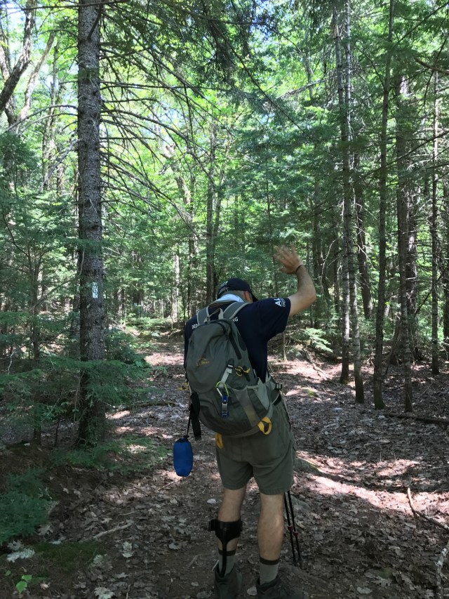
I caught my Dad in a totally non-staged wave as he bid a triumphant farewell to the AT for the final time. We’re on to Mt. Katahdin this weekend where the boy scouts and I will be summiting in his name!
“CAUTION: It is 100 miles south to the nearest town at Monson. There are no places to obtain supplies or help until Monson. Do not attempt this section unless you have a minimum of 10 days supplies and are fully equipped. This is the longest wilderness section of the entire AT and its difficulty should not be underestimated. Good Hiking!”
From Eileen: This is the sign that greeted Tori Barrow on July 1st as she, four friends and two counselors from Alford Lake Camp in Maine began their journey through the 100 Mile Wilderness, just part of their 300+ mile summer trek on the Appalachian Trail southbound from Mt. Katahdin through to New Hampshire. Tori is a rising high school sophomore, and her trail name is Tinkerbell. We are looking forward to learning how she got that name! Tori hiked the 100 Mile Wilderness in Rick’s name, sending letters along the way:
July 3 Mr. Marks & family, Hi! I’m not sure if you remember me (he does), but I remember you teaching me in children’s chapel and just around in church very well. I am so excited to hike the 100 mile wilderness in your name, and wish you the best of luck on the rest of your trip. To give you some background on my trip, it is out of Alford Lake Camp and is a 7 week trip that goes from Katahdin to the Mahoosuc Range. I am with 4 other kids, their names are Cate, Rae, Jonah and Andrea. I talked to them and they all said that they will hike the 100 mile wilderness for you and raising awareness for ALS. The first thing we did was Katahdin. It was 10 miles and we hiked up Hunt Trail and down Abol Trail. The next day we went from Katahdin Stream campground to Abol Pines State Campsite (9.9 miles). The next day we entered the 100 mile wilderness and hiked about 4 miles to the Hurd Brook lean-to. The next day we hiked to Rainbow Stream lean-to. It was covered in moss and is one of the most beautiful places I have ever been. That was 11.1 miles. Today we hiked 8 miles over Nesuntabunt Mountain to Wadleigh Stream lean-to. The views so far have been 100% worth the blisters and knees and mosquito bites, same as I assume from what I saw of your blog before I left. Once again my group (AMT XLIII) and I are absolutely ecstatic to hike for you and ALS. Best of luck for the rest of your hike. Hopefully we will run into each other on the trail. –Tori Barrow
in the same letter: Hi! I’m Cate! I’m hiking AMT with Tori. She has told us about you and it’s so cool you are hiking the AT! Just from my 5 days of hiking I’m amazed at people who are hiking! I’m so happy to support you and ALS! Good luck – Cate
July 8 Dear Mr. Marks & family, These past few days in the 100 mile wilderness have been fairly flat, with the exception of today and yesterday. After sending the letter that I last wrote you on our last food/gear re-supply, we hiked to Nahmakanta Stream campsite and then to Antlers campsite (7.8 miles) the next. This was beautiful, as it was on Lower Jo-Mary Lake and had a sand beach on the way, which we had lunch at and swam/washed off. The next day we hiked to Cooper Brook Falls lean-to which was a 7.9 mile hike. After that we went to Logan Brook lean-to which was my favorite because unlike the other campsites, there were almost NO bugs and the privy was nice. That was yesterday. Today we only hiked 5.4 miles to Sidney Tappan campsite but there was a lot of elevation change which my legs were not used to. Best of luck on the rest of your hike. –Tori Barrow
July 14 Mr. Marks & family, Hi from the 100 mile wilderness (actually we just finished it today!). We just finished hiking the Chairback Range and it was beautiful. We hiked 9.5 miles yesterday and 12 today. All the ponds are beautiful, and the views from above the tree line (especially toward the end) are amazing. I hope your hike is going well. A highlight (or lowlight) was getting an ENORMOUS leech in West Chairback Pond. It was like a snake coiling around my leg. Right now I am in Leeman Brook lean-to enjoying my sleeping bag. Hope to see you on the trail. –Tori
July 20 Hey Mr. Marks & family, Thanks for the note and bracelets and hat. I’m a little rushed (at resupply) but I really hope to see you on the trail. Happy hiking, –Tori
in the same letter:
Hi Rick! My name is Anarea. I’m the Spanish girl on AMT with Tori. She told me about doing the 100 mile wilderness for ALS & I joined her immediately. The 100m wilderness was hard, full with mosquitoes everywhere but so worth it! p.s. we got the bracelets, they are awesome –Anarea (Spain, Madrid)
Hi! My name is Rae, and I’m also hiking with Tori this summer. I hope you’re having an amazing hike and I hope to see you on the trail. We got the ALS bracelets and the whole trip is wearing them. Happy Trails!
Hello – I’m Jonah and I’m another member of Tori’s group. I think what you’re doing is really admirable and I’m proud to be a part of it. Good luck on the rest of your hike!
From Eileen: Thank you Tori, Cate, Anarea, Rae and Jonah for hiking this key section of the AT for Rick. We are very grateful for your help in raising awareness of ALS, and especially for your kind words and encouragement!
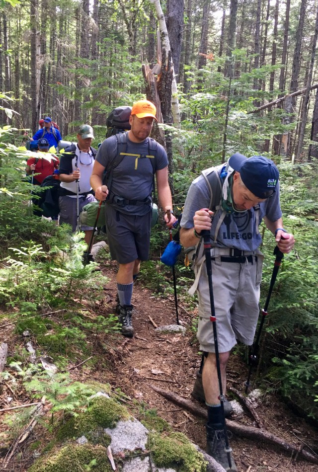
From Mark (Toad): With Day 1 (Day 45 for Rick) in the books, it was time for Day 2. Today was set to be the biggest day of our 3 days with Steady on the A/T. It would also prove to be more challenging as we were losing Floss and Moose due to previously planned vacation logistics. They were great wing men and would be missed! The rustling in camp started around 5:30 AM and by 6:00 we were all out of our cocoons and gathered to help break down, eat and pack up. The Jetboil and Gaz cookstoves were lit and the oatmeal was delish. I had smuggled in a few packs of Untapped Vermont Maple Syrup shots. Steady was in good spirits and we could tell he was rearing to tear out of camp. We were facing 10 very long miles to the next lean-to site at Pierce Pond. Once we started this section, there was no going back – it would be longer to backtrack than to push forward once we were a few miles in.
Reluctantly, we said our goodbyes to Floss and Moose. Steady immediately launched forward onto the trail. Boose took his spot at the back of the train and I began making careful work of picking lines through the rocks and roots surrounding the pond. We commented how the pond sections were really tricky (despite zero elevation gain). Little did we know what was to come later that day after our lunch at Sandy Beach. Hur caught up to us about 15 minutes in after finishing his packing and remarked at Steady’s excellent pace and cadence. Rest and food make a big impact on Steady, as ALS has an effect of really spiking the metabolism and Steady needed a big start this day. We passed through dense dark forests and swamps which looked to be prime Ewok habitat. In reality, they were homes for wood frogs, leopard frogs, American toads, green frogs and bull frogs. While we tracked a moose and saw some sign of bear, we never had our daylight encounter. Joe “Coffee” later showed me videos of the moose they ran into ahead of us, so we likely just missed our chance at a good sighting on the trail. After a few hours we approached another tough section. Finally, we could start to make out a break in the forest as we approached East Carry Pond Beach. The “Beach” (a rare 15-foot section of sand) was to be a welcome lunch spot for us. We were 3.7 miles in with 6.3 miles left to go and we were a bit behind schedule. In a surprise move, Steady opted to ditch his Ramen and share a dinner-sized meal of freeze-dried beef stroganoff with Hur. At the end of the trip they both agreed that this was their favorite meal in a bag.
We packed quickly and started out along the western edge of the pond. I had been picking blueberries here and there (and Steady had appreciated a few berries earlier in the morning) so we had a few more. This section of trail was exploding with ripe blueberries, but we had no time to stop so we snared what we could as we as we hiked past the bounty. Our progress immediately slowed however. Upon reaching the northern section of the pond we encountered a series of hewn log bridges over water. The doubles (two logs side by side) proved to be OK for Steady, but there were probably 15 single-log bridges with consequences. Many were elevated high above rocks and swamp. We provided the required guidance and side support for certain sections. Steady made consistent and incredible progress without our aid. “One step at a time, one foot in front of the other, nice and slow.” Before we could blink, another hour had ticked away, and we had barely left the pond. With about 5 miles down (and 5 to go) we started discussing contingencies. We took a break to give Steady some water (which makes Eileen very happy) and Steady relayed via his notepad that he was losing some strength and focus and didn’t want to fall at this stage. He asked where we could make camp. Boose, Hur and I consulted our AT app and decided on our “Plan B” for the day. We asked Steady if he could make about 1 more mile to a logging road near a water source, and he gave the thumbs up. We reached this waypoint around 3:30 PM, but water was not looking great and a spot to make camp was not immediately evident. We did find a box of trail magic designated for hikers, but it was picked through. The decision was made to set camp, but we also decided that I would need to continue forward to Pierce Pond so I could hike the final section to the Kennebec in the morning, cross the river, get my car, then extricate the crew around midday tomorrow. We figured I could make the first canoe ferry at 9:00 AM, which would require a 3.5-mile hike after packing up in the AM. I would then drive down the Kennebec around Wyman Lake, cross the river, then drive North through the logging roads to find the Plan B waypoint. We figured that with any luck, I could make it there by noon, but if for any reason I wasn’t there by 3:00PM, the plan was to call for assistance with Rick’s Sat Phone hook-up. Boose walked the first 3/10 of a mile to scope water with me, then he took Rick’s supplies and headed back. At 4:00 PM and with a lighter pack, I was now free to fly onto the Pierce Pond Shelter.
Upon arrival near sunset, I found the whole crew from the Carry Pond Lean-to inside the Pierce Pond Lean-to. They were excited to see me and had wondered if we were OK. I confirmed that all was well, but we had to adjust our plans on the fly and that Steady was settled back at Scott Road crossing. The Pierce Pond site was amazing, and I wished the group was here. The pond was refreshing, my hammock site was perfect and there was a sportsman’s camp .3 miles away that would serve a full hot breakfast at 7:00 AM for $12 – I thought the guys were lying to me. I desperately wanted Steady, Boose and Hur to experience all of this, but also knew that we had made the right decision – that Steady had made the right decision, and that we were all safe. I ate dinner with the crew lakeside and hit the hammock after we all shared a swig or two of High West whiskey from my flask. Morning came fast and Harrison’s Camp served us a mile-high stack of blueberry, apple & strawberry pancakes. I bought the lean-to crew b-fast and said my good byes. They were very appreciative and wished Steady the best. They were off to Caratunk then Katahdin bound, and I had to catch the 9:00 AM ferry.
I jog-hiked my way to the Kennebec from Harrison’s and made the first canoe crossing with Greg the ferry operator at 9:00 AM as planned. He got the last dollar in my wallet as a tip. I grabbed my car from the ferry lot and made it into Bingham to buy a plug kit and a can of fix-a-flat (just in case). Based on the logging roads I would likely be traveling on today, this was a prudent choice. I also grabbed some cokes, waters and Kit Kats for the boys. I arrived just before noon to smiling faces and more thumbs up (after only 2 wrong turns in the woods). No surprise…Steady was eating his Ramen.
Now we were off to find Hur’s truck back at our Flagstaff Lake starting point. We made the long haul south only to arrive at a closed gate to the access road leading into the Bigelow Preserve! The Native American landowners had closed the gate and posted a sign that they were doing road work. We now had to backtrack and go around the east side of the river to Flagstaff, adding another hour to retrieve the truck. We finally made it to Flagstaff and it started to rain a little. Quite appropriate actually, as this signaled that we had completed our 3-day adventure. It was OK for Mother Nature to rain now — Steady was off the trail and headed home, and he only brought good weather to the A/T! Steady was now my co-pilot back to home, and we shared what turned out to be a very unexpected and emotional moment. Rick’s son Philip and his Winchester a cappella group sang The National Anthem at Fenway Park as part of a contingent from the ALS Therapy Development Institute on Saturday night while we were out on the trail. Rick started playing the video from his iPhone once we had cell coverage. At this point we both completely lost it. Rick had what I’m sure were tears of both joy & sadness streaming down his face. I put a hand on his shoulder and tried to keep the tears from obscuring my vision of the Maine turnpike. What had started as a 9:30 AM drive in Maine ended at 7:30 PM back in Winchester. We were home.
Meanwhile, on another part of the A/T…
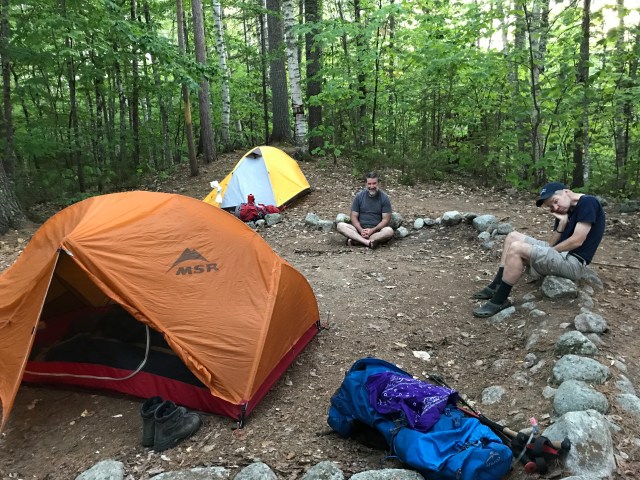
From Ben (Hur): Day 2 & 3 continued: After Mark took off on his race through the woods of Maine, Jed, Rick and I decided it was time to find a home for the night! We headed to higher ground where we cleared out some limbs and found some nice flat area for us to make home, and tried to avoid sleeping in a mosquito bed. With a thumbs up from Rick we knew that this was the spot. Once Jed, Rick and I had all made our homes for the night we then needed to do some work on the kitchen. I must admit that our kitchen/ living room wasn’t the best, but we made do, and greeted hikers as they raced through the woods to the next lean-to. Jed somehow still had his flask full, so we enjoyed that while DJ Rick spun some tunes on his phone. It was about 5pm so we decided to cook up another freeze-dried creation, and we all had a nice calm dinner. Our new home didn’t have any lake views, so we had to hike around for water, and found none. We quickly gained a lot of respect for the many hikers and their water management; you become very thirsty when you know you don’t have water. We decided it was time to turn in and the only thing we had to do tomorrow was find water, so a 7:30pm bedtime and we are done.
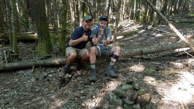
On Day 3 at about 5:30 I heard a rustling in the tent next to me, and I knew that Rick was on the move. At around 6 (sleeping in) I climbed out of my tent to find Rick with his pack completely full and he was now starting to break down his tent. I went into full pack mode and made some breakfast; I eventually woke Jed as I knew this train was going to leave the station if he didn’t get up soon. We decided to take it easy and hike to a stream a mile in, get water and then hike back to our meet up spot with Mark…or at least that’s what we thought. We got to the stream, and of course Steady pointed across the stream after looking at his watch; we hadn’t gone far enough :). We continued to hike through more rocks and rough terrain until finally Rick let us take a break. We looked at the clock and realized we should probably start heading back to the stream to fill up water then back to the meet up spot. Before we left we decided to create a Cairn to mark the trail with Rick, this was to create a mark for how far north we got that day. This was a pretty emotional time for the three of us, and we all helped put some rocks on to signify our great accomplishment.
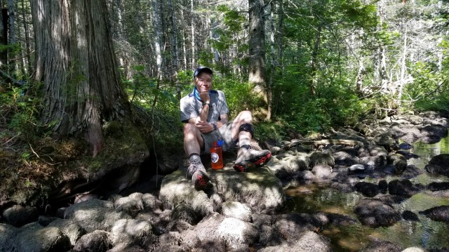
We went back to the stream and rested and got some water. Rick was on a beautiful rock by the stream and looked so comfortable, but that only lasted a few minutes as he was ready for more. I helped him off the rock and before you know we were on the trail again; and Jed would catch up with us once he was done pumping. This was the first time that Steady had led the way, and I wonder why anyone had ever gone in front of him because I think we were just slowing him down. We flew back to the road to meet Mark; Jed and I had a couple of espressos and Rick had some ramen. Within 20 minutes our savior arrived in the Volvo. We left each other 20 hours before and came within 15 minutes of our plan…amazing.
Words really can’t describe the experience that we had over those 4 days traveling and hiking in the great north. I feel so blessed to be a small part of Rick’s journey and to have moved into a neighborhood with such a giving, passionate, and caring group of people.
We are fortunate tonight to have two narrators for The Maxwell Road Adventures, Part I…
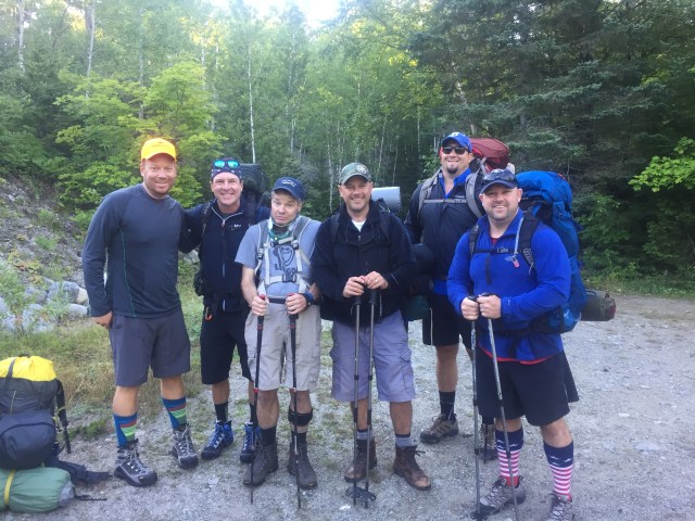
From Joe Wesolaski: We started near Sugarloaf Ski Resort in ME at Flagstaff Lake on Saturday, July 29th for an “easy” 6-mile cruise to the West Carry Pond Shelter. Ben Harding, Mark Budreski, Jed Sheehan, and I (all neighbors of Rick’s) and Ben Bell, my buddy visiting from Florida, all went to REI the week before and crammed to outfit ourselves so we could hit the trail ready with Steady. What we lacked in boy scouting skills we made up for in bravado and beer. We were committed to hiking in some refreshment for Rick, and ourselves of course, and the few extra lbs was a small price to pay.
We had perfect weather as we departed Saturday morning and started rounding the Southern lip of Flagstaff Lake and headed inland over some slight rollers. It was a cool and crisp day, and the sounds of singing loons on the lake kept us mesmerized as we churned through the first few miles. Steady was moving well and easily navigating the footbridges, mud sections, and elevation changes, and at one point even telling me to pick up the pace! About 2 hours in we heard a hiker fast approaching on our tail. We stepped aside to let him pass, and “House” quickly greeted Steady as an old friend. Steady and House had already met several times on the trail in VT and NH. The legend grows! Soon after seeing House we passed thru the 2000-mile mark on the AT. After a few photos and one-liners team Maxwell Road plodded on.
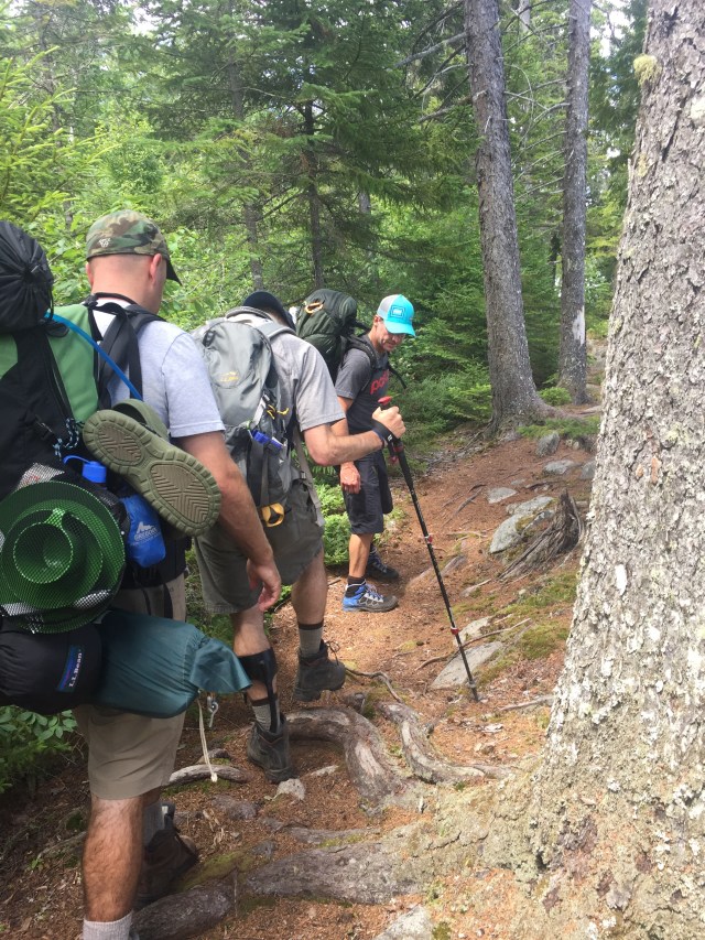
We turned inland from the lake and started to climb – the trail became a bit daunting with lots of roots, rocks, off-camber descents and some very narrow and overgrown sections. Rick was moving well and defied the odds more than once with some nimble foot placements over treacherous stream and rock crossings. Our quick morning pace had started to slow. There was nothing easy about this day as we reached 2000 feet in elevation at one point and the trail became increasingly difficult. Maybe it was the beer in our packs, but all the boys had aching shoulders as we legged out the final rooted stretch before the shelter.
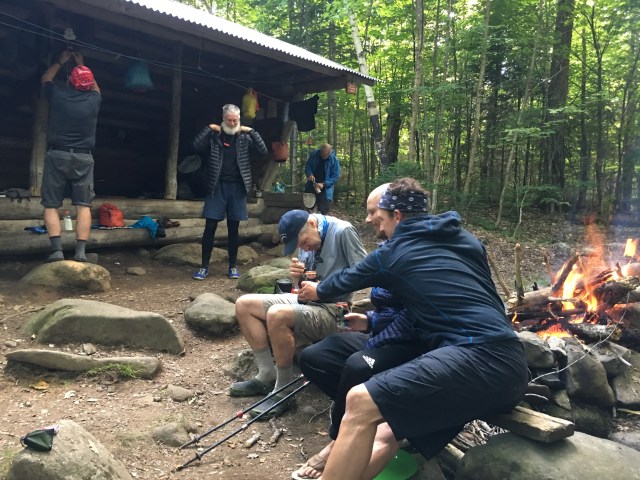
Upon arrival at the West Carry Pond Shelter we met a diverse crew of thru-hikers who were quickly impressed by Rick’s effort and accomplishments. There was a group of very experienced hikers from the South, travelling together with an impressive collection of white and grey beards. While they marveled at Rick, they were not shy about ribbing the rest of us over our AT naivety. “That freshness pack in your dehydrated meal won’t taste too good, you should probably remove it first before you add water.” The beer in our packs stayed remarkably cool, at least until we tried sinking it in the Pond to chill it further. Oddly enough it had the opposite effect – sorry Rick, your Long Trail was colder 30 minutes prior (but he didn’t seem to mind).
We all had tents and pitched camp near the shelter. A few of us awoke to the sounds of loud thuds scampering by in the middle of the night. Moose? Whatever it was it was big, not light on its feet, and a terrifying sound in the middle of the night!
The next morning Rick, Ben, Mark and Jed packed up and headed out. Before we left, one of the wise old sages of the trail came up to us and thanked us for what we were doing for Rick. He said it “restored his faith in humanity.” We said nearly in unison that Rick would have done the same for us, and it was the least we could do. Florida Ben had a plane to catch, so he and I doubled back the way we came. It was great to be out there with Rick if only for a day. Steady and the boys had a long stretch in front of them for Day 2 – we wished them well and sent them on their way.
****
From Mark Budreski:
It’s pretty hard to describe how amazing the last 3 days have been for all of us. Words could never do it justice, the incredible photos could never do it justice. I was trying to think about a summation point, and I think I have one, and it came through the eyes of other thru-hikers we met on the trail… The effect that Rick had on them was stunning.
Day 1: We left the shadows of the Bigelows from the southern tip of Flagstaff Lake. We weren’t 2 minutes out of the cars and into our packs before we made our first blunder—actually before I made my first blunder. We came upon a group of southbound hikers at our starting point, and they were of course friendly (like almost all hikers are). They inquired as to our plan and where we were headed, to which my immediate response was we are headed “EAST.” Technically, and while correct perhaps by way of our general compass bearing toward the mighty Kennebec, there are only TWO ANSWERS TO THIS QUESTION EVER. You either go North or you go South. Now that this was settled, we headed North (instead of East), even though it was ultimately all the same direction. This became a bit of a joke and a good way to get our trip started—despite the fact that we likely instilled the fear of god in Rick as he was quickly realizing the crew was a bit “green” to say the least.
Not more than 30 minutes into our trip we were passed by a nice guy with the trail name “House.” Rick and House had previously met in NH and VT, and this was their 3rd encounter on the AT. House had published a piece about Rick on his own blog to raise awareness. Couldn’t have been a nicer guy, wished us all well and kept trucking toward Katahdin. We were all in a bit of awe immediately. Rick had made multiple impressions on the first person we encountered out on the actual trail. It wasn’t too long before we realized how metered Rick’s efforts were, and how much concentration and deliberation went with each and every step that we all take for granted. The amount of mental and physical energy required to endure these extremely rugged and challenging sections of the AT is simply mind-blowing.
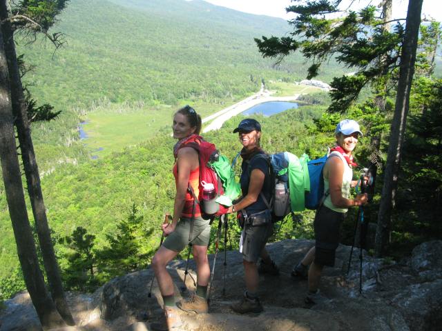
We made our lunch stop halfway to West Carry Pond, which was 6.5 miles from our starting point. We made Rick a seat and he enjoyed Ramen while we ate some squirrel food and Clif Bars. Shortly after lunch group of six passed us, descending from 2000′ feet through a boulder, chute en route to the West Carry Pond Lean-to. They said their hellos and hoofed it past. We arrived many hours later and they welcomed us to camp. This group was mostly middle-aged, recently retired sectioners, with the exception of 1 thru-hiker from the swamps of Louisiana. We soon learned all their trail names: Joe “Guiness,” Rick “Ragnar,” Jonathan “Red Mage,” Steve “Front Pockets” and Tim “Coffee.” They hadn’t realized exactly what we were all doing when they cruised past, but now that they got to meet Rick and sit down with us by the campfire, all perspectives were immediately re-adjusted. Without so much as saying a word, these guys were now on Rick’s team and had our back too. And this is how it would go for the next two days.
We settled into camp, and Rick got situated by the campfire with a Long Trail. A few of us had a swim (clothing optional), we watched the sun set and I think we all had a line on our trail names for the next few days… Joe W was “Floss.” He had complained about beef jerky being stuck in his teeth, and we weren’t going to let him live that down. Big Ben (Joe’s amazing friend from Florida who took time out of his family vacation in NH to join us) was “Moose.” Well deserved. Jed was “Boose” (to go with Moose, but also b/c he spent some time at the back of the train before honing the tip of the spear and leading Rick fearlessly later in the hike). Ben was carrying more than all of us and had Rick’s heaviest items I think. His role was sherpa, and in a Ben Hur-like fashion he rescued our own family, thus becoming “Hur.” I was “Toad.” With all trail names now in place, we settled into camp for the night to prepare for first light and Day #2. Tomorrow there would be a 10-mile hike through more challenging terrain en route to the Pierce Pond Lean-to.
From Eileen: I don’t have a lot of information to share from the trail yet, but the guys did send these two photos and reported that they had another good day of hiking. We should have a full report from this neighborhood crew tomorrow night!
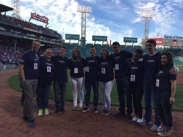
From Eileen: We are waiting to hear from the guys on the trail; we know they made it to the West Carry Pond Shelter near Flagstaff Lake in Maine this afternoon. Meanwhile, tonight was ALS Awareness night at the Red Sox game at Fenway Park. Our son Philip and I were honored to be there as part of the contingent from the ALS Therapy Development Institute of Cambridge, MA. Thank you to Carol Hamilton of ALSTDI for inviting us! Although Rick wasn’t there, he got a huge round of applause from the crowd during the introductions when the announcer told them that he is out hiking the Appalachian Trial for ALS. A special moment for us was when the Winchester High School Octets sang the national anthem. We want to thank the Red Sox organization and ALSTDI for giving them this opportunity, and Joel Buford for his support at the game.
Mr. Buford, Olivia, Eamon, Annabel, Luke, Madison, Dan, Zoe, Philip, and Sarah
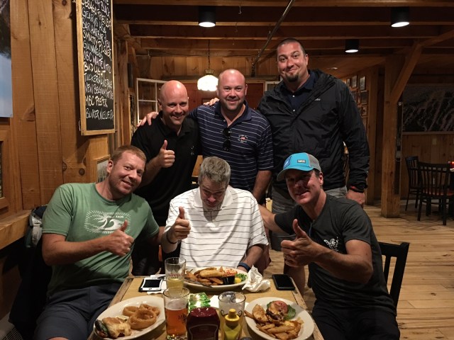
From Eileen: Rick left for Maine yesterday with a group of terrific guys from our neighborhood. Included in the group is Joe’s friend Ben, who is on vacation in New England with his family and enthusiastically accepted Joe’s invitation to join in the hike. I got this message from Mark last night: “We made it to dinner and dropped a car across the Kennebec. Rick is enjoying his Allagash White Beer at the Rack (at Sugarloaf) – off to bed soon so we can wake up at 5!!!”
Front row (l-r): Joe, Rick, and Mark; Back row (l-r) Ben, Jed, and Ben (Joe’s friend)
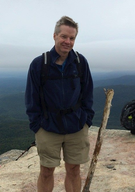
I am at home resting up, getting ready for another hike with friends from my neighborhood. I can feel that I am being more affected by ALS; I am not as strong as I used to be. It takes me longer to get ready to hike the AT each day, so I have to get up earlier (about 5 am) so that we can set off on time. Even so, I have enjoyed the last two weeks as I have climbed 5 mountains, including Mt. Washington. I am proud that I summitted the highest mountain in New England with my friends.
I am finishing up my epic hike on August 7th. I need to go back to work on August 8th, which is also the 30th wedding anniversary for Eileen and me. A month later I will celebrate my 30th anniversary at Bank of America, on September 8th. My last day at the bank is September 15th, after which I will go on long-term disability. I thank Bank of America for giving me time off to complete my hike.
My neighbors have offered their home in Maine as a base this weekend, which is awesome. I look forward to hiking and spending time with this group.
Boy Scouts from Troop 507 are climbing Mt. Katahdin on the last day of my hike. I doubt I will be able to climb Mt. Katahdin, even though I have climbed it twice, but I have no doubt that we will have a great time together.
I look forward to to raising more money by year end for ALS research.
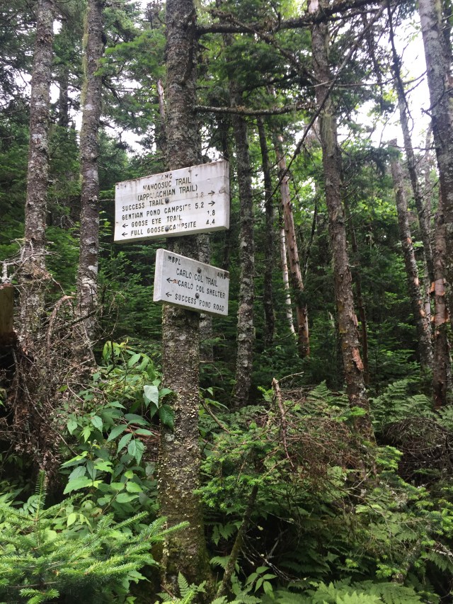
I spent the last two days hiking with Marty Mahoney and Dave Miranda. We met years ago on the soccer field when our boys were starting out in sandlot; hard to believe these same three boys just graduated high school! I want to thank my friends Marty and Dave for hiking with me in the Mahoosuc Range of Maine, which TheAppalachian Trail Guide to Maine describes as “some of the most difficult hiking anywhere on the A.T.” We stitched together a few sections (see Wombat’s blog on Day 34 for an explanation of “stitching”) over two rigorous days.
From Dave:
Day 1 We left Winchester Monday night and stayed at a hotel in NH so we could get an early start Tuesday morning. And an early start it was! Steady’s alarm went off at 5:30 am and he was showered and dressed before 6. We stopped at Dunkin’s for some breakfast and caffeine and then we hit the road.
We parked on a logging road and decided we were going to go up the Carlo Col trail. To get to the trail you have to walk along the logging road for a little bit. After about 10 minutes on the road Steady began to get nervous.
He asked Marty twice if we were on the right track, since we were on a road not a trail. Finally we came to the trailhead. Steady was relieved.
We got on the trail and all was good. I don’t know if it is proper etiquette for me to come up with a trail name, but I have one for Marty. It is Speedy. He was always 10 steps ahead of us. He was trying to find the best path for Steady, although I don’t think there were many options. He also tried to help by making sure the path was clear of loose sticks and rocks. He tried to “help” by putting this round and pointed rock in a stream we were crossing for Steady to use. It turned out to be so wobbly that Steady nearly fell in the stream when he stepped on it.
So of course I had to make that the running joke of the day, warning Steady not to step on anything Speedy “helped” set up. I think Steady laughed.
We proceeded to hike 2.4 miles to the Carlo Col shelter.
By the time we arrived, it was lunch time. Eileen had sent us with some subs, so we relaxed a little and enjoyed them.
After finishing lunch, we decided to head north on the AT toward Goose Eye mountain. We hiked for over an hour, but the trail became very steep and challenging. Steady was up for the challenge, but we got nervous about the trip down. We decided to change course and head south instead to the NH border.
After hiking another hour, we found the trail was even more challenging. You actually had to scale up some rocks to continue.
While Steady was up for the challenge, we decided against it. Since there was no place here left to hike, we had to come up with a plan b. Even though Steady had some yummy dehydrated goodies for supper, we decided we would leave the shelter.
We decided we would go to another hotel and start some place else first thing in the morning. So we hiked back to the car and went out to eat. We all ordered a beer and celebrated that Steady had passed the 100 mile mark today!!! Congratulations!!
Day 2 For day 2 we decided to head to Grafton Notch State Park. The three of us were ready for another day of hiking.
The parking lot was right on the AT, so we could start the hike immediately. We went on Old Speck trail towards the the top of Old Speck Mountain.
The weather was gorgeous and so was the trail. We passed a small waterfall.
The trail was easier than yesterday but still very challenging. There was a lot of difficult terrain including a few big steps.
Of course, no step was too big for Steady. He is hiking for his cause and no trail is going to stop him.
After several hours of hiking, we decided to stop for lunch. Speedy and I had talked about getting some subs in the morning to carry for lunch. Steady would have no part of it. He had brought some Ramen noodles and he was going to make those for us. I think he wanted to show off his camping skills.
After a couple of more hours hiking up we decided we needed to turn around so we could make it back to the car before dark. I am so happy I was able to be part of Rick’s hike for ALS. If you have a chance, be sure to take it!! A great time was had by all!!!